 Полная версия
Volcanic Islands
COAST DENUDATION.
The enormous cliffs, in many parts between one and two thousand feet in height, with which this prison-like island is surrounded, with the exception of only a few places, where narrow valleys descend to the coast, is the most striking feature in its scenery. We have seen that portions of the basaltic ring, two or three miles in length by one or two miles in breadth, and from one to two thousand feet in height, have been wholly removed. There are, also, ledges and banks of rock, rising out of profoundly deep water, and distant from the present coast between three and four miles, which, according to Mr. Seale, can be traced to the shore, and are found to be the continuations of certain well-known great dikes. The swell of the Atlantic Ocean has obviously been the active power in forming these cliffs; and it is interesting to observe that the lesser, though still great, height of the cliffs on the leeward and partially protected side of the island (extending from the Sugar-Loaf Hill to South West Point), corresponds with the lesser degree of exposure. When reflecting on the comparatively low coasts of many volcanic islands, which also stand exposed in the open ocean, and are apparently of considerable antiquity, the mind recoils from an attempt to grasp the number of centuries of exposure, necessary to have ground into mud and to have dispersed the enormous cubic mass of hard rock which has been pared off the circumference of this island. The contrast in the superficial state of St. Helena, compared with the nearest island, namely, Ascension, is very striking. At Ascension, the surfaces of the lava-streams are glossy, as if just poured forth, their boundaries are well defined, and they can often be traced to perfect craters, whence they were erupted; in the course of many long walks, I did not observe a single dike; and the coast round nearly the entire circumference is low, and has been eaten back (though too much stress must not be placed on this fact, as the island may have been subsiding) into a little wall only from ten to thirty feet high. Yet during the 340 years, since Ascension has been known, not even the feeblest signs of volcanic action have been recorded. (In the "Nautical Magazine" for 1835 page 642, and for 1838 page 361, and in the "Comptes Rendus" April 1838, accounts are given of a series of volcanic phenomena – earthquakes – troubled water – floating scoriae and columns of smoke – which have been observed at intervals since the middle of the last century, in a space of open sea between longitudes 20 degrees and 22 degrees west, about half a degree south of the equator. These facts seem to show, that an island or an archipelago is in process of formation in the middle of the Atlantic: a line joining St. Helena and Ascension, prolonged, intersects this slowly nascent focus of volcanic action.) On the other hand, at St. Helena, the course of no one stream of lava can be traced, either by the state of its boundaries or of its superficies; the mere wreck of one great crater is left; not the valleys only, but the surfaces of some of the highest hills, are interlaced by worn-down dikes, and, in many places, the denuded summits of great cones of injected rock stand exposed and naked; lastly, as we have seen, the entire circuit of the island has been deeply worn back into the grandest precipices.
CRATERS OF ELEVATION.
There is much resemblance in structure and in geological history between St. Helena, St. Jago, and Mauritius. All three islands are bounded (at least in the parts which I was able to examine) by a ring of basaltic mountains, now much broken, but evidently once continuous. These mountains have, or apparently once had, their escarpments steep towards the interior of the island, and their strata dip outwards. I was able to ascertain, only in a few cases, the inclination of the beds; nor was this easy, for the stratification was generally obscure, except when viewed from a distance. I feel, however, little doubt that, according to the researches of M. Elie de Beaumont, their average inclination is greater than that which they could have acquired, considering their thickness and compactness, by flowing down a sloping surface. At St. Helena, and at St. Jago, the basaltic strata rest on older and probably submarine beds of different composition. At all three islands, deluges of more recent lavas have flowed from the centre of the island, towards and between the basaltic mountains; and at St. Helena the central platform has been filled up by them. All three islands have been raised in mass. At Mauritius the sea, within a late geological period, must have reached to the foot of the basaltic mountains, as it now does at St. Helena; and at St. Jago it is cutting back the intermediate plain towards them. In these three islands, but especially at St. Jago and at Mauritius, when, standing on the summit of one of the old basaltic mountains, one looks in vain towards the centre of the island, – the point towards which the strata beneath one's feet, and of the mountains on each side, rudely converge, – for a source whence these strata could have been erupted; but one sees only a vast hollow platform stretched beneath, or piles of matter of more recent origin.
These basaltic mountains come, I presume, into the class of Craters of elevation: it is immaterial whether the rings were ever completely formed, for the portions which now exist have so uniform a structure, that, if they do not form fragments of true craters, they cannot be classed with ordinary lines of elevation. With respect to their origin, after having read the works of Mr. Lyell ("Principles of Geology" fifth edition volume 2 page 171.), and of MM. C. Prevost and Virlet, I cannot believe that the great central hollows have been formed by a simple dome-shaped elevation, and the consequent arching of the strata. On the other hand, I have very great difficulty in admitting that these basaltic mountains are merely the basal fragments of great volcanoes, of which the summits have either been blown off, or more probably swallowed up by subsidence. These rings are, in some instances, so immense, as at St. Jago and at Mauritius, and their occurrence is so frequent, that I can hardly persuade myself to adopt this explanation. Moreover, I suspect that the following circumstances, from their frequent concurrence, are someway connected together, – a connection not implied in either of the above views: namely, first, the broken state of the ring; showing that the now detached portions have been exposed to great denudation, and in some cases, perhaps, rendering it probable that the ring never was entire; secondly, the great amount of matter erupted from the central area after or during the formation of the ring; and thirdly, the elevation of the district in mass. As far as relates to the inclination of the strata being greater than that which the basal fragments of ordinary volcanoes would naturally possess, I can readily believe that this inclination might have been slowly acquired by that amount of elevation, of which, according to M. Elie de Beaumont, the numerous upfilled fissures or dikes are the evidence and the measure, – a view equally novel and important, which we owe to the researches of that geologist on Mount Etna.
A conjecture, including the above circumstances, occurred to me, when, – with my mind fully convinced, from the phenomena of 1835 in South America, that the forces which eject matter from volcanic orifices and raise continents in mass are identical, – I viewed that part of the coast of St. Jago, where the horizontally upraised, calcareous stratum dips into the sea, directly beneath a cone of subsequently erupted lava. (I have given a detailed account of these phenomena, in a paper read before the Geological Society in March 1838. At the instant of time, when an immense area was convulsed and a large tract elevated, the districts immediately surrounding several of the great vents in the Cordillera remained quiescent; the subterranean forces being apparently relieved by the eruptions, which then recommenced with great violence. An event of somewhat the same kind, but on an infinitely smaller scale, appears to have taken place, according to Abich ("Views of Vesuvius" plates 1 and 9), within the great crater of Vesuvius, where a platform on one side of a fissure was raised in mass twenty feet, whilst on the other side, a train of small volcanoes burst forth in eruption.) The conjecture is that, during the slow elevation of a volcanic district or island, in the centre of which one or more orifices continue open, and thus relieve the subterranean forces, the borders are elevated more than the central area; and that the portions thus upraised do not slope gently into the central, less elevated area, as does the calcareous stratum under the cone at St. Jago, and as does a large part of the circumference of Iceland, but that they are separated from it by curved faults. (It appears, from information communicated to me in the most obliging manner by M. E. Robert, that the circumferential parts of Iceland, which are composed of ancient basaltic strata alternating with tuff, dip inland, thus forming a gigantic saucer. M. Robert found that this was the case, with a few and quite local exceptions, for a space of coast several hundred miles in length. I find this statement corroborated, as far as regards one place, by Mackenzie in his "Travels" page 377, and in another place by some MS. notes kindly lent me by Dr. Holland. The coast is deeply indented by creeks, at the head of which the land is generally low. M. Robert informs me, that the inwardly dipping strata appear to extend as far as this line, and that their inclination usually corresponds with the slope of the surface, from the high coast-mountains to the low land at the head of these creeks. In the section described by Sir G. Mackenzie, the dip is 120. The interior parts of the island chiefly consist, as far as is known, of recently erupted matter. The great size, however, of Iceland, equalling the bulkiest part of England, ought perhaps to exclude it from the class of islands we have been considering; but I cannot avoid suspecting that if the coast-mountains, instead of gently sloping into the less elevated central area, had been separated from it by irregularly curved faults, the strata would have been tilted seaward, and a "Crater of elevation," like that of St. Jago or that of Mauritius, but of much vaster dimensions, would have been formed. I will only further remark, that the frequent occurrence of extensive lakes at the foot of large volcanoes, and the frequent association of volcanic and fresh-water strata, seem to indicate that the areas around volcanoes are apt to be depressed beneath the level of the adjoining country, either from having been less elevated, or from the effects of subsidence.) We might expect, from what we see along ordinary faults, that the strata on the upraised side, already dipping outwards from their original formation as lava-streams, would be tilted from the line of fault, and thus have their inclination increased. According to this hypothesis, which I am tempted to extend only to some few cases, it is not probable that the ring would ever be formed quite perfect; and from the elevation being slow, the upraised portions would generally be exposed to much denudation, and hence the ring become broken; we might also expect to find occasional inequalities in the dip of the upraised masses, as is the case at St. Jago. By this hypothesis the elevation of the districts in mass, and the flowing of deluges of lava from the central platforms, are likewise connected together. On this view the marginal basaltic mountains of the three foregoing islands might still be considered as forming "Craters of elevation;" the kind of elevation implied having been slow, and the central hollow or platform having been formed, not by the arching of the surface, but simply by that part having been upraised to a less height.
CHAPTER V. – GALAPAGOS ARCHIPELAGO
Chatham Island.
Craters composed of a peculiar kind of tuff.
Small basaltic craters, with hollows at their bases.
Albemarle Island; fluid lavas, their composition.
Craters of tuff; inclination of their exterior diverging strata, and structure of their interior converging strata.
James Island, segment of a small basaltic crater; fluidity and composition of its lava-streams, and of its ejected fragments.
Concluding remarks on the craters of tuff, and on the breached condition of their southern sides.
Mineralogical composition of the rocks of the archipelago.
Elevation of the land.
Direction of the fissures of eruption.
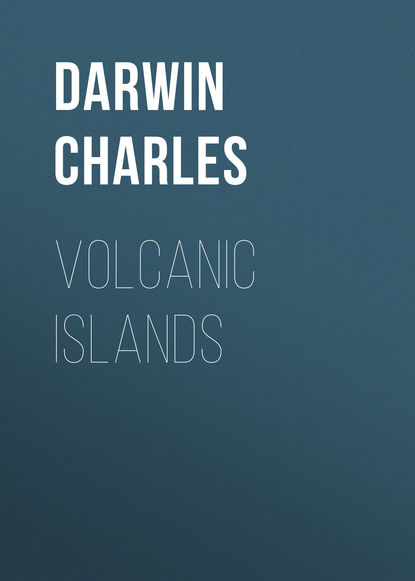
(FIGURE 11. MAP 3. GALAPAGOS ARCHIPELAGO.
Showing Wenman, Abingdon, Bindloes, Tower, Narborough, Albemarle, James,
Indefatigable, Barrington, Chatham, Charles and Hood's Islands.)
This archipelago is situated under the equator, at a distance of between five and six hundred miles from the west coast of South America. It consists of five principal islands, and of several small ones, which together are equal in area, but not in extent of land, to Sicily, conjointly with the Ionian Islands. (I exclude from this measurement, the small volcanic islands of Culpepper and Wenman, lying seventy miles northward of the group. Craters were visible on all the islands of the group, except on Towers Island, which is one of the lowest; this island is, however, formed of volcanic rocks.) They are all volcanic: on two, craters have been seen in eruption, and on several of the other islands, streams of lava have a recent appearance. The larger islands are chiefly composed of solid rock, and they rise with a tame outline to a height of between one and four thousand feet. They are sometimes, but not generally, surmounted by one principal orifice. The craters vary in size from mere spiracles to huge caldrons several miles in circumference; they are extraordinarily numerous, so that I should think, if enumerated, they would be found to exceed two thousand; they are formed either of scoriae and lava, or of a brown-coloured tuff; and these latter craters are in several respects remarkable. The whole group was surveyed by the officers of the "Beagle." I visited myself four of the principal islands, and received specimens from all the others. Under the head of the different islands I will describe only that which appears to me deserving of attention.
CHATHAM ISLAND. CRATERS COMPOSED OF A SINGULAR KIND OF TUFF.
Towards the eastern end of this island there occur two craters composed of two kinds of tuff; one kind being friable, like slightly consolidated ashes; and the other compact, and of a different nature from anything which I have met with described. This latter substance, where it is best characterised, is of a yellowish-brown colour, translucent, and with a lustre somewhat resembling resin; it is brittle, with an angular, rough, and very irregular fracture, sometimes, however, being slightly granular, and even obscurely crystalline: it can readily be scratched with a knife, yet some points are hard enough just to mark common glass; it fuses with ease into a blackish-green glass. The mass contains numerous broken crystals of olivine and augite, and small particles of black and brown scoriae; it is often traversed by thin seams of calcareous matter. It generally affects a nodular or concretionary structure. In a hand specimen, this substance would certainly be mistaken for a pale and peculiar variety of pitchstone; but when seen in mass its stratification, and the numerous layers of fragments of basalt, both angular and rounded, at once render its subaqueous origin evident. An examination of a series of specimens shows that this resin-like substance results from a chemical change on small particles of pale and dark-coloured scoriaceous rocks; and this change could be distinctly traced in different stages round the edges of even the same particle. The position near the coast of all the craters composed of this kind of tuff or peperino, and their breached condition, renders it probable that they were all formed when standing immersed in the sea; considering this circumstance, together with the remarkable absence of large beds of ashes in the whole archipelago, I think it highly probable that much the greater part of the tuff has originated from the trituration of fragments of the grey, basaltic lavas in the mouths of craters standing in the sea. It may be asked whether the heated water within these craters has produced this singular change in the small scoriaceous particles and given to them their translucent, resin-like fracture. Or has the associated lime played any part in this change? I ask these questions from having found at St. Jago, in the Cape de Verde Islands, that where a great stream of molten lava has flowed over a calcareous bottom into the sea, the outermost film, which in other parts resembles pitchstone, is changed, apparently by its contact with the carbonate of lime, into a resin-like substance, precisely like the best characterised specimens of the tuff from this archipelago. (The concretions containing lime, which I have described at Ascension, as formed in a bed of ashes, present some degree of resemblance to this substance, but they have not a resinous fracture. At St. Helena, also, I found veins of a somewhat similar, compact, but non- resinous substance, occurring in a bed of pumiceous ashes, apparently free from calcareous matter: in neither of these cases could heat have acted.)
To return to the two craters: one of them stands at the distance of a league from the coast, the intervening tract consisting of a calcareous tuff, apparently of submarine origin. This crater consists of a circle of hills some of which stand quite detached, but all have a very regular, qua- qua versal dip, at an inclination of between thirty and forty degrees. The lower beds, to the thickness of several hundred feet, consist of the resin- like stone, with embedded fragments of lava. The upper beds, which are between thirty and forty feet in thickness, are composed of a thinly stratified, fine-grained, harsh, friable, brown-coloured tuff, or peperino. (Those geologists who restrict the term of "tuff" to ashes of a white colour, resulting from the attrition of feldspathic lavas, would call these brown-coloured strata "peperino.") A central mass without any stratification, which must formerly have occupied the hollow of the crater, but is now attached only to a few of the circumferential hills, consists of a tuff, intermediate in character between that with a resin-like, and that with an earthy fracture. This mass contains white calcareous matter in small patches. The second crater (520 feet in height) must have existed until the eruption of a recent, great stream of lava, as a separate islet; a fine section, worn by the sea, shows a grand funnel-shaped mass of basalt, surrounded by steep, sloping flanks of tuff, having in parts an earthy, and in others a semi-resinous fracture. The tuff is traversed by several broad, vertical dikes, with smooth and parallel sides, which I did not doubt were formed of basalt, until I actually broke off fragments. These dikes, however, consist of tuff like that of the surrounding strata, but more compact, and with a smoother fracture; hence we must conclude, that fissures were formed and filled up with the finer mud or tuff from the crater, before its interior was occupied, as it now is, by a solidified pool of basalt. Other fissures have been subsequently formed, parallel to these singular dikes, and are merely filled with loose rubbish. The change from ordinary scoriaceous particles to the substance with a semi-resinous fracture, could be clearly followed in portions of the compact tuff of these dikes.
(FIGURE 12. THE KICKER ROCK, 400 FEET HIGH.)
At the distance of a few miles from these two craters, stands the Kicker Rock, or islet, remarkable from its singular form. It is unstratified, and is composed of compact tuff, in parts having the resin-like fracture. It is probable that this amorphous mass, like that similar mass in the case first described, once filled up the central hollow of a crater, and that its flanks, or sloping walls, have since been worn quite away by the sea, in which it stands exposed.
SMALL BASALTIC CRATERS.
A bare, undulating tract, at the eastern end of Chatham Island, is remarkable from the number, proximity, and form of the small basaltic craters with which it is studded. They consist, either of a mere conical pile, or, but less commonly, of a circle, of black and red, glossy scoriae, partially cemented together. They vary in diameter from thirty to one hundred and fifty yards, and rise from about fifty to one hundred feet above the level of the surrounding plain. From one small eminence, I counted sixty of these craters, all of which were within a third of a mile from each other, and many were much closer. I measured the distance between two very small craters, and found that it was only thirty yards from the summit-rim of one to the rim of the other. Small streams of black, basaltic lava, containing olivine and much glassy feldspar, have flowed from many, but not from all of these craters. The surfaces of the more recent streams were exceedingly rugged, and were crossed by great fissures; the older streams were only a little less rugged; and they were all blended and mingled together in complete confusion. The different growth, however, of the trees on the streams, often plainly marked their different ages. Had it not been for this latter character, the streams could in few cases have been distinguished; and, consequently, this wide undulatory tract might have (as probably many tracts have) been erroneously considered as formed by one great deluge of lava, instead of by a multitude of small streams, erupted from many small orifices.
In several parts of this tract, and especially at the base of the small craters, there are circular pits, with perpendicular sides, from twenty to forty feet deep. At the foot of one small crater, there were three of these pits. They have probably been formed, by the falling in of the roofs of small caverns. (M. Elie de Beaumont has described ("Mem. pour servir" etc. tome 4 page 113) many "petits cirques d'eboulement" on Etna, of some of which the origin is historically known.) In other parts, there are mammiform hillocks, which resemble great bubbles of lava, with their summits fissured by irregular cracks, which appeared, upon entering them, to be very deep; lava has not flowed from these hillocks. There are, also, other very regular, mammiform hillocks, composed of stratified lava, and surmounted by circular, steep-sided hollows, which, I suppose have been formed by a body of gas, first, arching the strata into one of the bubble- like hillocks, and then, blowing off its summit. These several kinds of hillocks and pits, as well as the numerous, small, scoriaceous craters, all show that this tract has been penetrated, almost like a sieve, by the passage of heated vapours. The more regular hillocks could only have been heaved up, whilst the lava was in a softened state. (Sir G. Mackenzie "Travels in Iceland" pages 389 to 392, has described a plain of lava at the foot of Hecla, everywhere heaved up into great bubbles or blisters. Sir George states that this cavernous lava composes the uppermost stratum; and the same fact is affirmed by Von Buch "Descript. des Isles Canaries" page 159, with respect to the basaltic stream near Rialejo, in Teneriffe. It appears singular that it should be the upper streams that are chiefly cavernous, for one sees no reason why the upper and lower should not have been equally affected at different times; – have the inferior streams flowed beneath the pressure of the sea, and thus been flattened, after the passage through them, of bodies of gas?)
ALBEMARLE ISLAND.
This island consists of five, great, flat-topped craters, which, together with the one on the adjoining island of Narborough, singularly resemble each other, in form and height. The southern one is 4,700 feet high, two others are 3,720 feet, a third only 50 feet higher, and the remaining ones apparently of nearly the same height. Three of these are situated on one line, and their craters appear elongated in nearly the same direction. The northern crater, which is not the largest, was found by the triangulation to measure, externally, no less than three miles and one-eighth of a mile in diameter. Over the lips of these great, broad caldrons, and from little orifices near their summits, deluges of black lava have flowed down their naked sides.

